


Description
05 Jan 2024
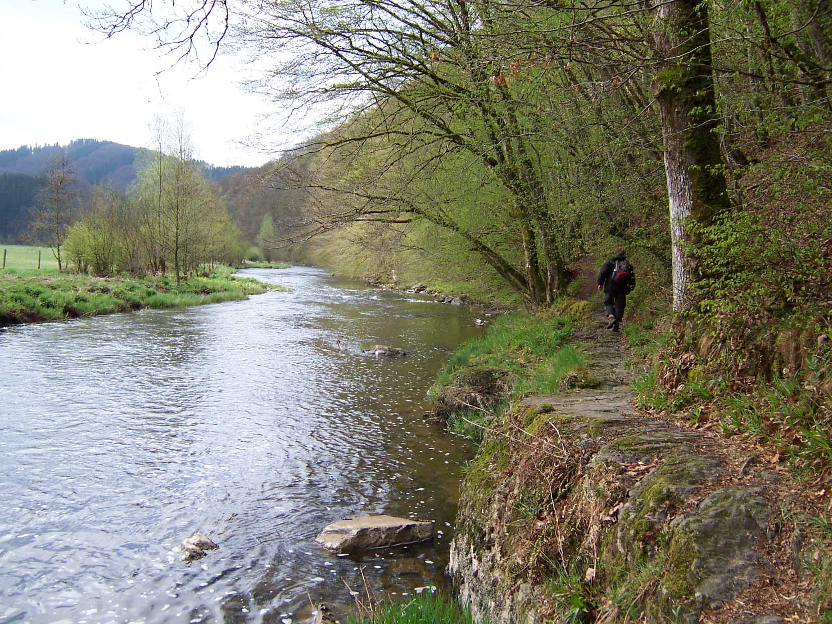
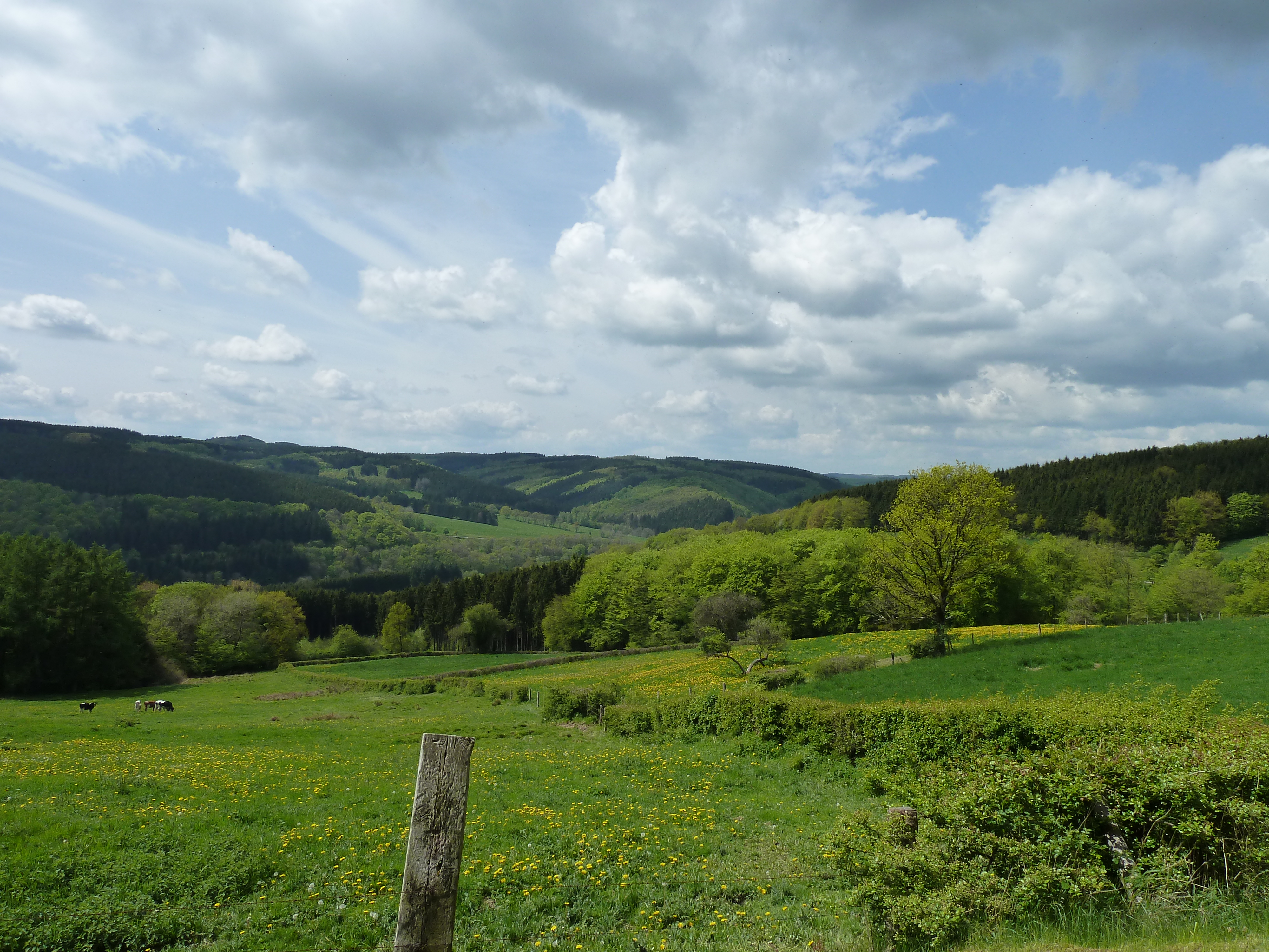
In order to improve people’s knowledge about the Ardennes and the Oesling, six loop trails of varying lengths are also available for the hiking fraternity …
In addition to the Escapardenne Eislek Trail, these are designed to highlight a variety of themes, such as the forest landscapes, plateaus and valleys, small-scale heritage, views, sites or other natural elements. These different hiking tours may be completed over several days with different stops in the accommodation facilities located along the trails or close by (see applications on the “Belgium network” site).
“Luggage-free” packages are also on offer from our partners: www.europaventure.be et www.trekaventure.com
N.B.: these trails are not signposted on the ground, so we advice you to use the “Cirkwi” facility (print hiking guides, download GPS tracks or the application for mobile phones) to get your bearings or get hold of one of the IGN maps available in the tourist information centres and tourism centres in the region.


Before setting off, you should decide the distance you wish to hike. If you want to walk all of a loop, a subdivision per day of hiking is one option.
How to follow them?
- For the traditional hiker, four 1: 25 000 and 1: 30 000 scale maps carefully following the routes are available from the Deux Ourthes Natural Park tourist information centres and the Luxembourg Ardennes Regional Tourism Office
- For the hiker keen on new technologies, the maps that can be downloaded from the Belgian network site and using your GPS or your Smartphone will enable you to get your bearings. . Give in to temptation!
Map 1: one hiking tour
- 101km – From the depths of the forests to the landscapes on the plateau (La Roche-en-Ardenne – Tenneville – Laneuville-au-Bois – Lavacherie – Hubermont – Gives – Bertogne – Nadrin –La Roche-en-Ardenne)
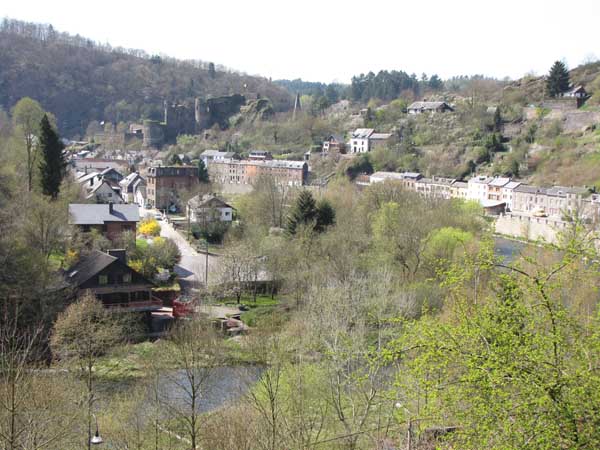
Starting from La Roche-en-Ardenne, the loop climbs directly to the plateaus of the central Ardennes. Several villages and hamlets are crossed within the municipalities of Tenneville, Sainte-Ode and Bertogne. Between these, the trail mainly travels along farm and forest roads. Subsequent to an incursion into the forest, it drops down to the confluence to cross the Ourthe and reach the starting point where you can discover several views, such as those towards the Nisramont dam or towards the village of Maboge.
Map 2: two hiking tours
- 30km – From Ourthe valley to the Vallée des Fées (Nadrin – Wibrin – Achouffe – Nadrin)
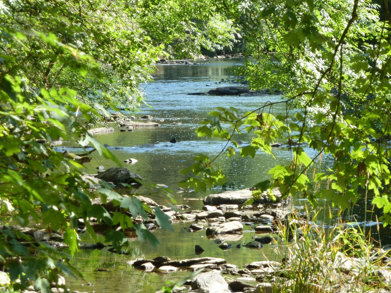
Starting from Nadrin, the loop leads to Bérismenil via Cheslé, in the tracks of the Celts. Crossing Wibrin wood leads to the village with the same name. Direction Achouffe following the mysterious Vallée des Fées. After you have stopped a while for refreshments, a long shadowy passage takes you to the eastern river area of the Ourthe and its majestic twisting and turnings. The energetic climb back up is followed by a return to Nadrin via the splendid villages of Filly and Ollomont.
- 55km – From the plateau of Les Tailles to the Bernistap canal (Houffalize – Achouffe – Les Tailles – Cherain – Rettigny – Steinbach – Houffalize)
Starting from Houffalize, the loop leads to the village of Achouffe and the Vallée des Fées. After crossing the Cedrogne wood you head towards the Fens. After stepping across the E 25 motorway, you travel towards the municipality of Gouvy to cross the villages of Mont-le-Ban, Cherain, Rettigny and Steinbach. The Belgo-Luxembourg border is where you find the demarcation of the Trail via the Bernistap canal, to reach Houffalize afterwards.
Map 3: two hiking tours
- 53km – Between the Meuse and the Rhine, the cross-border loop (Gouvy – Rettigny – Steinbach – Asselborn – Troisvierges – Hoffelt – Ourthe – Gouvy)
Starting from Gouvy the hiking tour takes the magnificent path winding through the natural valley in the eastern river area of the Ourthe, which is still quite tiny at this location … It rises again to the plateau where a viewing table surveys the scene. The heritage in the village of Steinbach is the next stop before crossing the border and setting off towards the Asselborn mill then crossing the splendid natural areas to arrive at Troisvierges. Another few kilometres before the catchment area and the sources of the river Ourthe enable you to reach your starting point.
- 43 km – Between Woltz and Our, in unspoilt nature (Troisvierges – Weiswampach – Heinerscheid – Troisvierges)
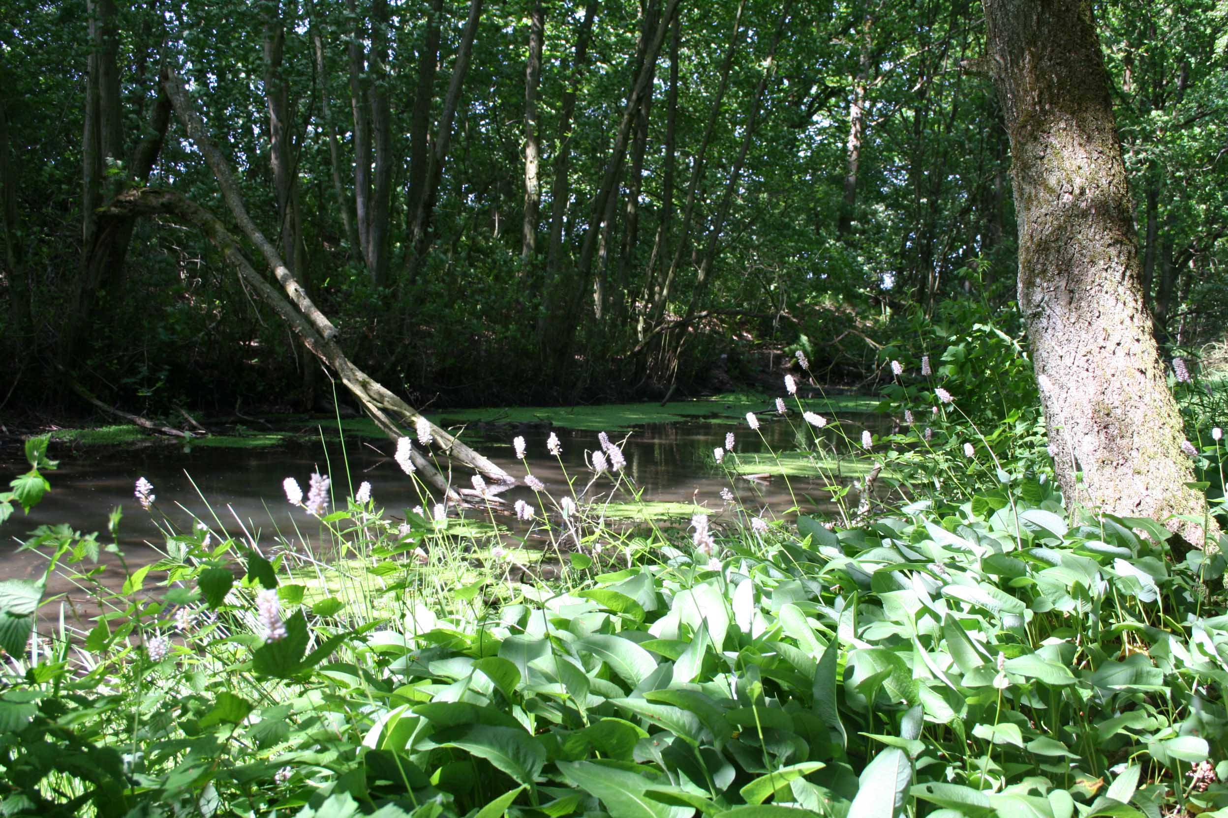
Starting from Troisvierges you take the old railway line to reach Goedange whereupon you cross the Eisleck plateau and the natural peaty areas around Conzefenn. Heading off next towards Weiswampach and the Our valley, at the crossroads of three countries. The hiking tour then rises again towards the heights of the plateau to reach Heinerscheid followed by Hupperdange. It runs alongside Wemperbaach valley up to the Maulusmillen site. The final section leads back to Troisvierges..
Map 4: one hiking tour
- 80km – The hidden landscapes of the West Eislek (Kautenbach – Wiltz – Derenbach – Clervaux – Munshausen – Kautenbach)
This trail loop covers an area much appreciated by hikers: the Luxembourg Ardennes between Clervaux, Kautenbach and Wiltz. In a location linking Wiltz to Clervaux via the western part of the Éislek, visitors can discover a fairly unknown region, out of sight, where splendid hidden landscapes are revealed one minute after another.
-
 ESCAPARDENNE
GEOMAP VIRTUAL
TOUR -
 CIRKWI
 iOS
iOS
 Android
-
VENTE EN LIGNE • BUY ONLINE
 TOPOGUIDE & CARTE • MAP