


Introduction
10 Feb 2017
Escapardenne Lee Trail, a follow-up to the Escapardenne Eislek Trail
The great hiking route Escapardenne Lee Trail, 53km long, forms part of a programme that aims to enhance an existing quality cross-border product, namely the Escapardenne Eislek Trail – 104km which link Kautenbach (L) and La Roche–en-Ardenne (B) – and its six loops, by connecting them namely to an important tourism centre in the North of the Grand-Duchy of Luxembourg: Ettelbruck.
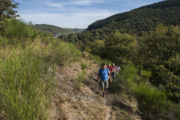
Starting from Ettelbruck station (L), you will take numerous natural little paths, follow countless rocky ridges (“Lee”) and cross the Sauer valley several times to then climb back up towards the high, exposed Ardennes plateaus and savour the impressive panoramic views over the meandering bends of the Sauer.
Signposted in both directions and divided up into 3 days of walking, the ESCAPARDENNE Lee Trail passes through ten small villages or hamlets to link the village of Kautenbach and its train station. This long trek that crosses the Ardennes of Luxembourg, known as “cut up” – the Ardennes plateau being threaded with watercourses and deep, encased valleys – is loved by all walkers in search of heritage, nature, culture and, of course, the countryside.
We wish you all a pleasant trip discovering authentic Ardennes!
The Trail in figures :
• 2000m of elevation gain
• More than 60% in a natural state
• Less than 20% with an asphalted surface
• 16 natural sites crossed or followed
• 32 outstanding views
• 1 towns and 10 villages or hamlets crossed.
Same marking to Escapardenne Eislek Trail
3 stages :
Ettelbruck – Bourscheid-Moulin : 17,6 km
Bourscheid-Moulin – Hoscheid : 19,6 km
Hoscheid – Kautenbach: 15 km
-
 ESCAPARDENNE
GEOMAP VIRTUAL
TOUR -
 CIRKWI
 iOS
iOS
 Android
-
VENTE EN LIGNE • BUY ONLINE
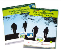 TOPOGUIDE & CARTE • MAP