


Escapardenne Eislek Trail
08 Jan 2020
Escapardenne Eislek Trail : trail description between Kautenbach and La Roche-en-Ardenne
The Eislek Trail stands out by its pristine nature on both sides of the Belgo-Luxembourg border and its rich cultural heritage one can discover along the 106 kilometres of the trail.
A 106 km hiking trail can hardly be covered within one day… so the following stages are recommended:
Kautenbach – Clervaux: 25 km or Munshausen: 21 km
Clervaux – Asselborn: 20 km
Asselborn – Houffalize: 20 km
Houffalize – Nadrin: 23 km
Nadrin – La Roche-en-Ardenne: 18 km

The signs clearly show how to get from A to B in both directions
A comparatively well-detailed map provides an overview of the 106 km journey and the division into stages.
Map of the Escapardenne Eislek Trail
La Roche-en-Ardenne – Nadrin – Houffalize – Asselborn – Troisvierges – Clervaux – Munshausen – Kautenbach
A guidebook features the stages, maps for these stages, various items of information about the trail (height differences, altitudes, difficulty…), an accurate description of the historical, archaeological, natural or landscape heritage encountered along the section …
A few places to find accommodation, catering and transport facilities are available for each stage.
Discover the six loop trails in the Ardennes on four maps!
Apart from the straight-line route, six loop trails of varying lengths are available to help you wear out your boots …
N.B.: they are not signposted but follow local signposted hiking paths maintained by the tourist information offices or parts of other trails established by various operators.
One part of each trail also follows the Escapardenne Eislek Trail.
See discovery loops tab
-
 ESCAPARDENNE
GEOMAP VIRTUAL
TOUR -
 CIRKWI
 iOS
iOS
 Android
-
VENTE EN LIGNE • BUY ONLINE
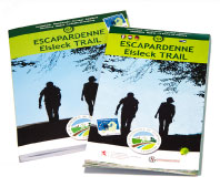 TOPOGUIDE & CARTE • MAP